✨ New Arrivals Just Dropped!Explore

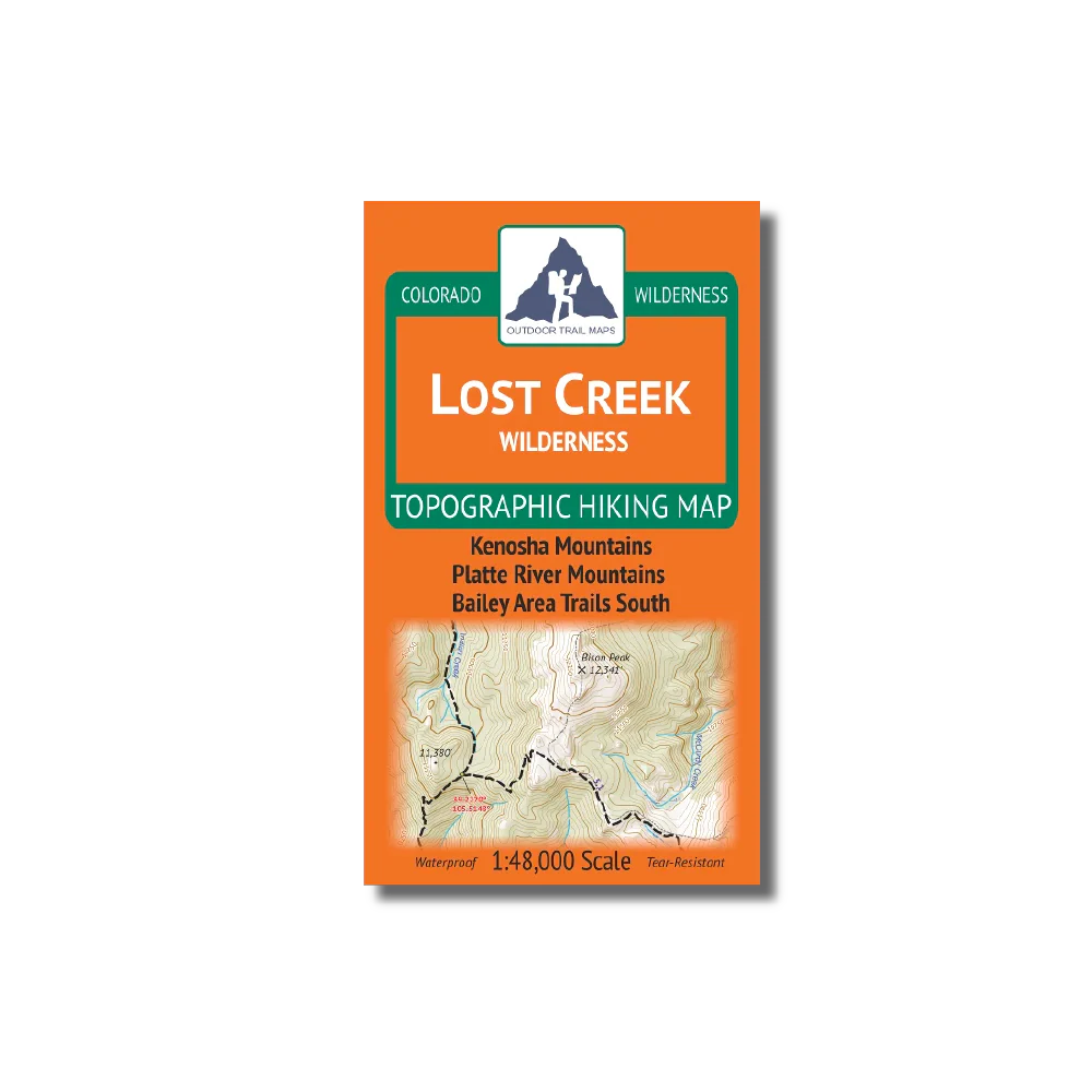
Outdoor Trail Maps Lost Creek Wilderness Map
- Waterproof and tear-resistant – designed for on-trail use in harsh conditions
- 1:48,000 scale (1 in ≈ 0.7 mi)
- Smaller size (4”x7” folded, 27”x19” unfolded) and light weight – under 2 oz
- Trail segment mileages for all trails
- Lat-long coordinates for all trailheads and key trail junctions
- 50 ft contour lines
- Accurate, intuitive and easy-to-use
This wilderness area spans 115,000 acres across the Front Range only 40 miles southwest of Denver.
Product Information
Product Information
Shipping & Returns
Shipping & Returns
Outdoor Trail Maps Lost Creek Wilderness Map
Outdoor Trail Maps Lost Creek Wilderness Map
- Waterproof and tear-resistant – designed for on-trail use in harsh conditions
- 1:48,000 scale (1 in ≈ 0.7 mi)
- Smaller size (4”x7” folded, 27”x19” unfolded) and light weight – under 2 oz
- Trail segment mileages for all trails
- Lat-long coordinates for all trailheads and key trail junctions
- 50 ft contour lines
- Accurate, intuitive and easy-to-use
This wilderness area spans 115,000 acres across the Front Range only 40 miles southwest of Denver.
$3.15
Original: $8.99
-65%Outdoor Trail Maps Lost Creek Wilderness Map—
$8.99
$3.15Product Information
Product Information
Shipping & Returns
Shipping & Returns
Description
- Waterproof and tear-resistant – designed for on-trail use in harsh conditions
- 1:48,000 scale (1 in ≈ 0.7 mi)
- Smaller size (4”x7” folded, 27”x19” unfolded) and light weight – under 2 oz
- Trail segment mileages for all trails
- Lat-long coordinates for all trailheads and key trail junctions
- 50 ft contour lines
- Accurate, intuitive and easy-to-use
This wilderness area spans 115,000 acres across the Front Range only 40 miles southwest of Denver.